The Past Harvests Project
The Past Harvests Project
Posted by es970
25 February 2026Powderham Castle was once served by its own harbour where the River Kenn and River Exe estuary meet. Following recent flooding, these rivers had reclaimed lost ground, submerging much of the castle grounds and the marshland beyond.
Thankfully, by the time of our visit in early February, the floodwaters had receded a little, granting us safe passage along the access road.
The purpose of our trip was to extract untapped documentary data from the castle archives recording historic farming methods and land-use on the surrounding estate.
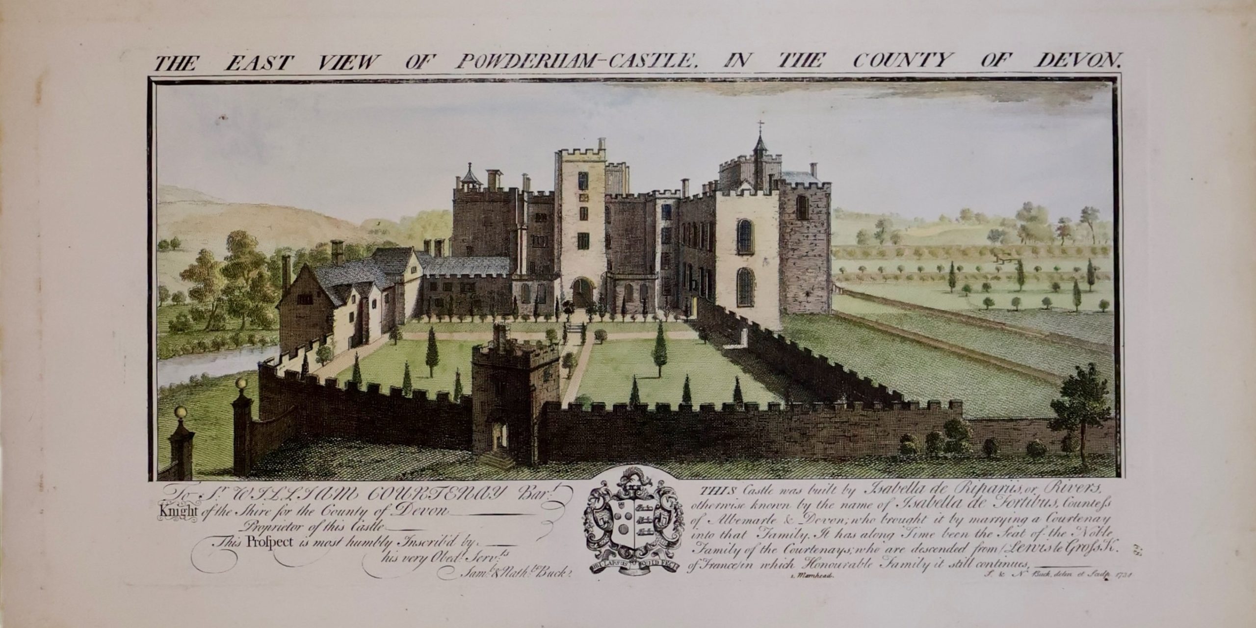
We focused our efforts on a large wooden box in the archives containing maps and engravings (including the Buck brothers’ 1734 depiction of Powderham Castle above).
Maps, particularly those from the eighteenth-century onwards, are especially useful since they provide vital base layers allowing us to reconstruct field sizes, predominant agricultural practices and ownership at specific moments in time.
The 1787 George Lang Survey is a case in point. It incorporates detailed, carefully measured maps of individual farms and districts along with descriptions of field areas, field names and tenure. The region covered includes the nearby manors of Kenton, Alphington, and Exminster.
Our team left Powderham in sufficient time to avoid the rising tides of the bloated River Exe which, to judge from the high-water mark, had not long ago engulfed the only road out of the castle.
We are now working to make sense of our findings. More anon!
Alexander Hibberts, Postdoctoral Research Associate on the Past Harvests Project
The above picture is the Buck Brothers illustration of the east view of Powderham Castle in Devon.