
“Social sensing” is a form of crowd-sourcing that involves systematic analysis of digital communications to detect real-world events. Here we consider the use of social sensing for observing natural hazards. In particular, we present a case study that uses data from a popular social media platform (Twitter) to detect and locate flood events in the UK. In order to improve data quality we apply a number of filters (timezone, simple text filters and a naive Bayes ‘relevance’ filter) to the data. We then use place names in the user profile and message text to infer the location of the tweets. These two steps remove most of the irrelevant tweets and yield orders of magnitude more located tweets than we have by relying on geo-tagged data. We demonstrate that high resolution social sensing of floods is feasible and we can produce high-quality historical and real-time maps of floods using Twitter.
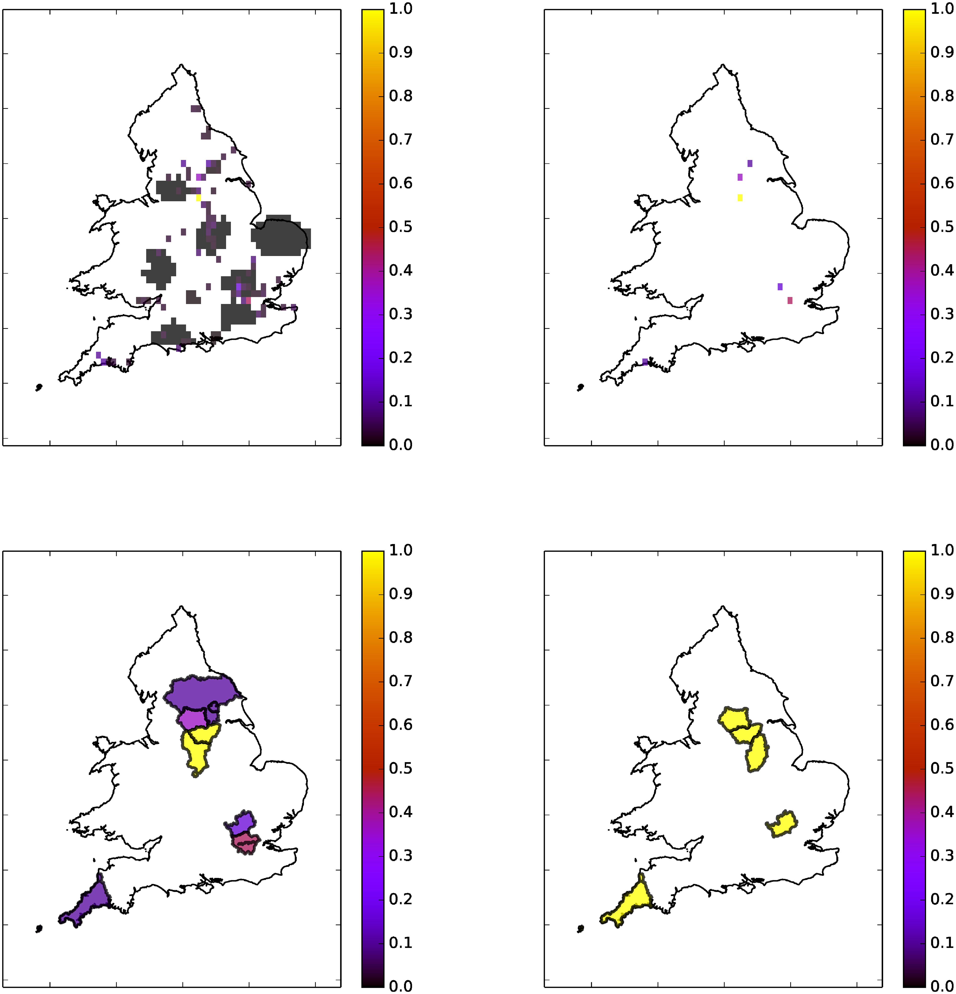
Using tweets collected in 1 hour windows. White indicates no tweets. Colour bar units are floodiness relative to daily max. Top left: 10am-11am. Top Right: 1pm-2pm. Bottom Left: 4pm-5pm. Bottom Right: 9pm-10pm.